
Our address data files
We provide address data files in CSV format which is well supported by a wide range of tools, databases and programming languages.
A typical address data file contains millions of rows and is several gigabytes in size; a UK address data file has around 30 million rows and is 4 GB in size.
Since address data files tend to be very large, we recommend you import the address data into a database and then process it further from there, as per your requirements.
If you wish to view the data before that, you can use a text editor with large file support like EmEditor. Note, we don't recommend using Microsoft Excel as it can struggle to open large files.
Get A Free Quote

UK address data sources
Allies address data for the UK provides you with easy access to these datasets:
Royal Mail
PAF - Royal Mail's definitive UK address database. Updated daily, PAF is the most accurate and up-to-date record of every postal address in the UK.
Multiple Residence - The Multiple Residence database from Royal Mail identifies individual dwellings within multiple occupancy buildings that share a front door.
Not Yet Built - The Not Yet Built database from Royal Mail contains the addresses of 500,000 properties that are planned or under construction.
Alias - Alias data is used with the Postcode Address File (PAF) to help identify properties that have additional address characteristics.
British Forces Post Office - British Forces Post Office (BFPO) postcodes are used to ensure the accurate routing of commercial and personal mail to British Forces personnel serving overseas.
Office for National Statistics
ONS Postcode Directory - The Office for National Statistics (ONS) assigns geographies to postcodes using the ONS Postcode Directory (ONSPD).
Get A Free QuoteUK address data levels
We provide different levels of address data and, if required, can include geographical data with all of them.
Premise
Our premise address data contains full addresses (also known as delivery points). For example:
| Address | Field |
|---|---|
| Maple Widgets Ltd | OrganisationName |
| Holly House | BuildingName |
| Oak Avenue | MainStreet |
| Biddenden | DependentLocality |
| ASHFORD | PostTown |
| TN27 8BT | Postcode |
Our UK address data includes Royal Mail PAF and Multiple Residence data, and can be supplied in one of two ways:
One record per delivery point
- Our most popular format where your address data file contains one address per line
One record per postcode record
- An alternative format where your address data file contains one postcode record per line
- Each postcode record can contain up to 100 addresses
- One postcode record is supplied for each combination of street(s) and user category
- Where provided, premise information for each address within the postcode record is encoded within the fields for
DepartmentName,OrganisationName,SubBuildingName,BuildingName,BuildingNumber,DeliveryPointSuffix,UniqueDeliveryPointReferenceNumber, with semi-colons separating the values. For example: ";;Flat 1" forSubBuildingNamewould mean the first two delivery points at that postcode have no sub-building names, and the third has a sub-building name of "Flat 1"
Street
Our street address data includes Royal Mail Part PAF and provides the street, locality, town, county and postcode. For example:
| Street | Field |
|---|---|
| Oak Avenue | MainStreet |
| Biddenden | DependentLocality |
| ASHFORD | PostTown |
| TN27 8BT | Postcode |
Locality
Our locality address data provides fields for locality, town, county and postcode. For example:
| Locality | Field |
|---|---|
| Biddenden | DependentLocality |
| ASHFORD | PostTown |
| TN27 8BT | Postcode |
Geographic
Geographic data (or geo data for short) can be included with any of the three levels of address data above. For each postcode (except non-geographical postcodes like GIR 0AA or XM4 5HQ), the following geo data is available:
- Grid references for Ordnance Survey 1m units
- Latitude and Longitude for OSGB36 and ETRS89 latitude and longitude, derived from 1m grid references
- European / National / Local government codes and names
- NHS administrative codes and names
- 2001 and 2011 census codes


UK postcode structure
The first part of the postcode is called the outward code, or outcode, and directs the mail to a sorting office. It comprises 1-2 letters (the postcode area), followed by 1-2 numerals (the postcode district).
The second part of the postcode, after the space, is called the inward code, or incode. This is used to sort the mail into a postal delivery "walk". It comprises a letter (which, in conjuction with the outcode, identifies the postcode sector) followed by two numerals, making up the complete postcode unit.
UK address data fields
Premise fields
| Data level ✔ = Standard ♦ = Optional | ||||||
|---|---|---|---|---|---|---|
| Field name Alternative field name | Description | Premise | Street | Locality | Geo | Max length |
OrganisationNameORC | Organisation Name The name of the organsation. | ✔ | 60 | |||
DepartmentNameORD | Department Name The department within the organisation. | ✔ | 60 | |||
POBoxNumberPOB | PO Box Number The PO Box number (optionally with a "PO Box" prefix or other custom text). Not always a number, can be an alphanumberic value (e.g. PO Box LB6). | ✔ | 6/13 | |||
SubBuildingNameSBN | Sub Building Name The sub-building name (e.g. Flat 1 or Unit A). | ✔ | 30 | |||
BuildingNameBNA | Building Name The name of the building (e.g. Rose Cottage, Bush Tower). | ✔ | 50 | |||
BuildingNumberNUM | Building Number The building number (e.g. 6, 4A, 22-24). If the tidy premise option has been selected, then this field will be blank, and the building number (if any) will be prefixed to the first populated field for DependentStreet, MainStreet, DoubleDependentLocality or DependentLocality. | ✔ | 12 | |||
DeliveryPointSuffixDPX | Delivery Point Suffix A 2-character code (one numeric and one alphabetic) plus 1 check digit calculated from the postcode and the actual Delivery Point Suffix (e.g. 3AB). It enables each delivery point to be uniquely identified within a postcode. | ✔ | 3 | |||
UniqueDeliveryPointReferenceNumberURN | Unique Delivery Point Reference Number (UDPRN) A unique reference to this delivery point which will not change even if the postcode or other PAF elements change. | ✔ | 8 | |||
DataOriginDTO | Data Origin The origin of the data with values of P for PAF and M for Multiple Residence. | ✔ | 1 | |||
UniqueMultipleResidenceReferenceNumberUMR | Unique Multiple Residence Reference Number (UMRRN) A unique reference equivalent to the UDPRN in PAF. By default, this value is output in the UniqueDeliveryPointReferenceNumber field. | ♦ | 8 | |||
MultipleOccupancyCountMOC | Multiple Occupancy Count A count of the number of multiple occupancy addresses for the delivery point (max 9999). This value is supplied by Royal Mail. This is the same for every Multiple Residence record for a given owning PAF delivery point, and will be present on the owning PAF delivery point record as well. | ✔ | 4 | |||
MultipleResidenceRecordCountMRC | Multiple Residence Record Count The actual count of Multiple Residence records following the PAF delivery point record (max 9999). This value is computed from the actual data. It may be less than MultipleOccupancyCount if Royal Mail do not have all details of the Multiple Residence addresses, and may even be zero. Usually however it will be the same as MultipleOccupancyCount. As with MultipleOccupancyCount, MultipleResidenceRecordCount is the same for every Multiple Residence record and the owning delivery point. | ✔ | 4 | |||
Street fields
| Data level ✔ = Standard ♦ = Optional | ||||||
|---|---|---|---|---|---|---|
| Field name Alternative field name | Description | Premise | Street | Locality | Geo | Max length |
DependentStreetDST | Dependent Street The dependent street or thoroughfare. | ✔ | ✔ | 80 | ||
MainStreetSTM | Main Street The main or only street. | ✔ | ✔ | 80 | ||
DoubleDependentLocalityDDL | Double Dependent Locality A business park, industrial estate or hamlet which is smaller than a dependent locality, sometimes included in an address. | ✔ | ✔ | ✔ | 35 | |
DependentLocalityDLO | Dependent Locality A small town or village name sometimes included in an address when the address is outside the boundary of the post town that serves it. | ✔ | ✔ | ✔ | 35 | |
PostTownPTN | Post Town | ✔ | ✔ | ✔ | 30 | |
PostcodePCD | Postcode E.g. NR14 7PZ | ✔ | ✔ | ✔ | ✔ | 8 |
PostcodeAreaPAR | Postcode Area E.g. NR | ♦ | ♦ | ♦ | ♦ | 2 |
PostcodeDistrictPDI, PSD | Postcode District E.g. NR14 | ♦ | ♦ | ♦ | ♦ | 4 |
PostcodeSectorPSI | Postcode Sector E.g. NR 14 7 | ♦ | ♦ | ♦ | ♦ | 6 |
PostcodeGroupPGR | Postcode Group E.g. NR14 7P | ♦ | ♦ | ♦ | ♦ | 7 |
CurrentCountyCCN | Current County Maintained by Allies and always populated. The county has not been a required postal addressing element for some time by Royal Mail, and the county fields still found in PAF ( AdministrativeCounty, PostalCounty, TraditionalCounty) are not always populated or up to date, however some users still require a county for their own purposes. The mapping of postcodes to CurrentCounty is generated by Allies using a variety of geographic information sources including the latest map set and the new unitary authorities. CurrentCounty represents the administrative district under which a given postcode falls. See also ElectoralCountyName. | ✔ | ✔ | ✔ | 30 | |
AdministrativeCountyCTA | Administrative County Top tier local government. Note that the AdministrativeCounty is only relevant in areas which still have three tiers of local government (i.e. county council, local authority, ward). Since the early 2000s local government has been moving to unitary authorities where there is no county council. Not always populated, use ElectoralCountyName in preference. | ♦ | ♦ | ♦ | 30 | |
PostalCountyCTP | Former Postal County Formerly maintained by Royal Mail as part of the mail sorting process. Prior to introduction of postcodes this was an important part of the delivery process. No longer needed for addresses and not maintained since 1996. Does not necessarily correspond to a resident's own concept of their county. Not always populated. | ♦ | ♦ | ♦ | 30 | |
TraditionalCountyCTT | Traditional County Reflects the counties from 1888 until 1974. This is often what residents still perceive as their correct county, but it bears no direct relevance to the current local administrative arrangements. Not always populated. | ♦ | ♦ | ♦ | 30 | |
UserCategoryCAT | User category R=Residential, N=Non-residential, L=Large. Residential covers non-business premises. Non-residential covers small to medium businesses. Large user is for large businesses and PO Boxes (which can also be rented by individuals). Large users each have their own postcode. | ✔ | ✔ | ✔ | 1 | |
SortcodeSCD | Sortcode For Royal Mail Mailsort. | ✔ | ✔ | ✔ | 5 | |
DeliveryPointCountNDP, DPS | Delivery Point Count Number of delivery points in this postcode record, not the entire postcode (there can be 1 or more records for each postcode). Max value is 100. Where postcode records have been aggregated so that there is one data record per PAF postcode, DeliveryPointCount will be the total delivery point count for the postcode. | ✔ | ✔ | ✔ | 3 | |
CountryCodeCTRY | Country Code | ♦ | ♦ | ♦ | ♦ | 9 |
CountryNameLNN | Country Name | ♦ | ♦ | ♦ | ♦ | 30 |
Geographic fields
| Data level ✔ = Standard ♦ = Optional | ||||||
|---|---|---|---|---|---|---|
| Field name Alternative field name | Description | Premise | Street | Locality | Geo | Max length |
| Geographic: Mapping and navigational fields | ||||||
GridEast1metreGME | Grid Easting Grid easting in metres (1m units) E.g. 626980 | ✔ | 6 | |||
GridNorth1metreGMN | Grid Nothing Grid northing in metres (1m units) E.g. 0303951 | ✔ | 7 | |||
LatitudeOSGB36LTO | OSGB36 Latitude E.g. 52.5855368359 | ✔ | 15 | |||
LongitudeOSGB36LGO | OSGB36 Longitude E.g. 1.3510181044 | ✔ | 15 | |||
LatitudeETRS89LTE | ETRS89 Latitude E.g. 52.5859714116 | ✔ | 15 | |||
LongitudeETRS89LGE | ETRS89 Longitude E.g. 1.3492192897 | ✔ | 15 | |||
| Geographic: European / National / Local government fields | ||||||
EuropeanElectoralRegionCodeEER | European Electoral Region Code E.g. E15000006 | ✔ | 9 | |||
EuropeanElectoralRegionNameEERName | European Electoral Region Name E.g. Eastern | ✔ | 40 | |||
ParliamentaryConstituencyCodePCON | Westminster Parliamentary Constituency Code E.g. E14000941 | ✔ | 9 | |||
ParliamentaryConstituencyNamePCONName | Westminster Parliamentary Constituency Name E.g. South Norfolk | ✔ | 50 | |||
ElectoralCountyCodeOSCTY | Electoral County Code E.g. E10000020 | ✔ | 9 | |||
ElectoralCountyNameOSCTYName | Electoral County Name E.g. Norfolk | ✔ | 30 | |||
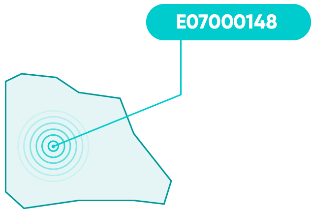
LocalAuthorityCodeOSLAUA | Local or Unitary Authority Code E.g. E07000149 | ✔ | 9 | |||
LocalAuthorityNameWNA, OSLAUAName | Local or Unitary Authority Name E.g. South Norfolk | ✔ | 60 | |||
ElectoralWardCodeOSWARD | Electoral Ward Code E.g. E05005903 | ✔ | 9 | |||
ElectoralWardNameWNW, OSWARDName | Electoral Ward Name E.g. Poringland with the Framinghams | ✔ | 40 | |||
ParishCodePARISH | Parish Code | ♦ | 9 | |||
| Geographic: Health administration fields | ||||||
CommissioningRegionCode_NHS | NHS Commissioning Region Code 3-character NHS code:
| ✔ | 3 | |||
CommissioningRegionCode_GSSCR_GSS | CommissioningRegionCode_GSS 9-character GSS code:
| ♦ | 9 | |||
CommissioningRegionNameNNR, CRName | Commissioning Region Name
| ✔ | 30 | |||
AreaTeamCode_NHSNHS | NHS Area Team Code 3-character NHS code:
| ✔ | 3 | |||
AreaTeamCode_GSSAT | GSS Area Team Code 9-character GSS code:
| ♦ | 9 | |||
AreaTeamNameNNH, ATName | Area Team Name
| ✔ | 40 | |||
ClinicalCommissioningGroupCode_NHSPCG | NHS Clinical Commissioning Group Code 3-character NHS code:
| ✔ | 3 | |||
ClinicalCommissioningGroupCode_GSSCCG | GSS Clinical Commissioning Group Code 9-character GSS code:
| ♦ | 9 | |||
ClinicalCommissioningGroupNamePNP, CCGName | Clinical Commissioning Group Name
| ✔ | 40 | |||
| Geographic: 2001 Census fields | ||||||
CensusOutputArea_2001OA01 | 2001 Census Output Area | ♦ | 9 | |||
CensusOutputAreaClassification_2001OAC01 | 2001 Census Output Area classification | ♦ | 9 | |||
CensusLowerLayerSuperOutputArea_2001LSOA01 | 2001 Census Lower Layer Super Output Area | ♦ | 9 | |||
CensusMiddleLayerSuperOutputArea_2001MSOA01 | 2001 Census Middle Layer Super Output Area | ♦ | 9 | |||
CensusUrbanRuralIndicator_2001UR01IND | 2001 Census Urban/Rural Indicator | ♦ | 1 | |||
CensusAreaStatisticsWardCodeCASWARD | 2001 Census Area Statistics (CAS) Ward | ♦ | 6 | |||
| Geographic: 2011 Census fields | ||||||
CensusOutputArea_2011OA11 | 2011 Census Output Area | ♦ | 9 | |||
CensusOutputAreaClassification_2011OAC11 | 2011 Census Output Area classification | ♦ | 9 | |||
CensusLowerLayerSuperOutputArea_2011LSOA11 | 2011 Census Lower Layer Super Output Area | ♦ | 9 | |||
CensusMiddleLayerSuperOutputArea_2011MSOA11 | 2011 Census Middle Layer Super Output Area | ♦ | 9 | |||
CensusRuralUrbanIndicator_2011RU11IND | 2011 Census Rural/Urban Indicator | ♦ | 1 | |||
CensusWorkplaceZone_2011WZ11 | 2011 Census Workplace Zone | ♦ | 9 | |||
BuiltUpAreaBUA11 | 2011 Census Built Up Area | ♦ | 9 | |||
BuiltUpAreaSubdivisionBUASD11 | 2011 Census Built Up Area Sub-Division | ♦ | 9 | |||
| Geographic: Other fields | ||||||
StatisticalWardCode_2005STATSWARD | 2005 Statistical Ward | ♦ | 6 | |||
PostcodeDateOfIntroductionDOINTR | Date of Introduction of Postcode | ♦ | 6 | |||
PostcodeDateOfTerminationDOTERM | Date of Termination of Postcode | ♦ | 6 | |||
NationalParkCodePARK | National Park Code | ♦ | 9 | |||
NationalParkNamePARKName | National Park Name | ♦ | 60 | |||
UserType | User Category S=Small, L=Large. | ♦ | 1 | |||
GridPositionalQualityIndicatorOSGRIDIND | Grid Reference Positional Quality Indicator | ♦ | 1 | |||
RegionCodeGOR | Region Code Formerly government office region code. | ♦ | 9 | |||
RegionNameGORName | Region Name Formerly government office region name. | ♦ | 40 | |||
StandardStatisticalRegionCodeSTREG | Standard Statistical Region Code | ♦ | 1 | |||
StandardStatisticalRegionNameSTREGName | Standard Statistical Region Name | ♦ | 40 | |||
TravelToWorkAreaCodeTTWA | Travel to Work Area Code | ♦ | 9 | |||
NUTSCodeNUTS | Nomenclature of Units for Territorial Statistics (NUTS) Code | ♦ | 9 | |||
Additional geographic information
Mapping and navigational fields
Grid references
Our grid references locate the centroid of a postcode in units of 1m.
Grid references are included for the most of the UK, with the exception of postcodes that belong to PO Boxes.
The Channel Islands (postcode areas JE and GY) and the Isle of Man (postcode area IM) are available as an option, these having been calculated by Allies at postcode district level on the same basis as the UK mainland grid. Note that northings for the Channel Islands are negative numbers.
The Northern Ireland (postcode area BT) grid does not have the same origin as the one used for the rest of the United Kingdom. An approximate conversion of Northern Ireland grid references to the same origin as the rest of the UK is obtained by adding 13000 to the northing and subtracting 17000 from the easting of the NI references. This should not be regarded as an exact conversion.
The UK grid runs out in the far north of Scotland, where a letter is used for the first digit of the grid northing in order to retain a 6 character reference. However, for ease of use we supply a 7 digit numeric grid reference which can be used directly with other UK grid references.
OSGB36 coordinates
Our OSGB36 coordinates are expressed in degrees for the 1m grid reference for a postcode; 15 digits: sign, 3 digits, decimal point, 10 decimal places.
These latitude & longitude values are given on the Airey 1830 ellipsoid and reference the OSGB36 datum. The values correspond to those on current OS Maps for Great Britain. Northern Ireland values are computed using the Irish Transverse Mercator projection.
Longitude east of Greenwich is a positive decimal value. Longitude west of Greenwich is a negative decimal value.
ETRS89 coordinates
Our ETRS89 coordinates are expressed in degrees for the 1m grid reference for a postcode; 15 digits: sign, 3 digits, decimal point, 10 decimal places.
These latitude and longitude values are given on the WGS84 ellipsoid and reference the ETRS89 datum. The values correspond to those used in global positioning systems in Great Britain and Europe. Note that many online map providers such as Google Maps use GPS maps and hence the ETRS89 latitude and longitude coordinates should be used with these providers.
Longitude east of Greenwich is a positive decimal value. Longitude west of Greenwich is a negative decimal value.
Get A Free Quote
Local government fields
Units of local government administration differ between countries in the UK. For the purposes of naming fields we use the name of the English unit but the following notes also indicate the equivalent units within other countries.
From January 2011 ONS introduced a new 9-character coding structure for most current statistical geographies in the UK, but excluding Northern Ireland.
The previous ward code was presented as a single value, although it was made up of three components:
- County (if any)
- Authority
- Ward
The new codes are provided separately for each component and are structured as follows:
The first character is a letter representing the country:
- E = England
- W = Wales
- S = Scotland
- L = Channel Islands
- M = Isle of Man
The next two characters are a 2-digit entity code:
- 10 = County
- 09 = London borough
- 08 = Metropolitan district
- 07 = Local authority (non-metropolitan district)
- 05 = Electoral Ward
Abolished or not applicable records will have the Instance (last six digits of the code) set to 999999.
The final six characters are a 6-digit instance code. This number is simply an identifier which is unique within the country and entity. It has no structural meaning so there is no relationship between two adjacent numbers.

Local authority or unitary authority code
For a given postcode, this code identifies the:
- Local authority district (LAD)
- Unitary authority (UA)
- Metropolitan district (MD)
- London borough (LB)
- Council area (C) - Scotland
- District council area (DCA) - Northern Ireland
These codes are now in the 9-character format, except for Northern Ireland where they remain 6 characters in length. Local authority codes in the 9-character format have the entity codes:
- 09 = London borough
- 08 = Metropolitan district (England)
- 07 = Local authority (England)
- 06 = Unitary Authority (England and Wales)
- 12 = Council area (Scotland)
Electoral ward code
This code identifies the electoral ward for the postcode.
These codes are now in the 9-character format, except for Northern Ireland where they remain 6 characters in length. Ward codes in the 9-char format have the entity code 05.
The codes for Northern Ireland have not changed: the ward code has an embedded blank. The county part is always 95, the 26 local authorities have the letters A-Z plus one space and the ward is two digits.
Local government examples
| Electoral county | Local or unitary authority | Ward | Old code | |
|---|---|---|---|---|
| Local authority | E10000020 (Norfolk) | E07000149 (South Norfolk) | E05005924 (Mulbarton) | 33UHJW |
| Unitary authority | E99999999 | E06000057 (Northumberland) | E05009101 (Bellingham) | EMQG |
| Metropolitan district | E99999999 | E08000003 (Manchester) | E05000697 (City Centre) | BNGX |
| London borough | E99999999 | E09000023 (Lewisham) | E05000442 (Downham) | AZGJ |
| Northern Ireland | 95 (Northern Ireland) | 95A (Derry) | 12 (Victoria) | 95A 12 |
| Scotland | S99999999 | S12000028 (South Ayrshire) | S13002786 (Girvan and South Carrick) | REMH |
| Wales | W99999999 | W06000002 (Gwynedd) | W05000100 (Porthmadog-Tremadog) | NCSP |
Health administration
Units of health administration differ between countries in the UK. For the purposes of naming data fields we use the name of the English unit but the following notes also indicate the equivalent units within other countries within the UK.
From January 2011, ONS introduced a new 9-character coding structure for most current statistical geographies in the UK, including health, but excluding Northern Ireland.
The pre-existing 3-character coding system continues to be used within the NHS, hence we provide either or both sets of codes within our address data. There is no stated internal structure to the 3-character code but in fact all English health authorities start with the letter Q and Welsh ones with W. Scottish health boards start with S and Northern Irish with Z.
Furthermore, in April 2013 the administration of the NHS in England was changed, and the previous:
- Pan strategic health authority
- Strategic health authority
- Primary care trust
were replaced by:
- Commissioning region
- Area team
- Clinical commissioning group
Commissioning region
The commissioning region is the region responsible for the associated area teams and clinical commissioning groups for postcodes in England. Pseudo codes are included for Wales, Scotland, Northern Ireland, Channel Islands and Isle of Man. Note, these entities seem to be known by different labels, such as regional teams or commissioning boards, even within the NHS.
Two codes and a name are available:
Commissioning RegionCode_NHS- a 3-character code used by the NHS for the entityCommissioning RegionCode_GSS- a 9-character GSS code for the entityCommissioning RegionName- the name of the entity

Area team
For a given postcode, this code identifies the:
- Area team (AT) - England
- Health board (HB) - Scotland
- Health authority (HA) - Channel Islands and Isle of Man
- Health & Social Care board (HSCB) - Northern Ireland
Two codes and a name are available:
AreaTeamCode_NHS- a 3-character code used by the NHS for the entityAreaTeamCode_GSS- a 9-character GSS code for the entityAreaTeamName- the name of the entity
There is no stated internal structure to the 3-character code but in fact all English health authorities start with the letter Q and Welsh ones with W. Scottish health boards start with S and Northern Irish with Z.

Clinical Commissioning Group
For a given postcode, this code identifies:
- Clinical commissioning group (CCG) - England
- Local health board (LHB) - Wales
- Community health partnership (CHP) - Scotland
- Local commissioning group (LCG) - Northern Ireland
- Primary healthcare directorate (PHD) - Isle of Man
Two codes and a name are available:
ClinicalCommissioningGroupCode_NHS- 3-character code used by the NHS for the entityClinicalCommissioningGroupCode_GSS- 9-character GSS code for the entityClinicalCommissioningGroupName- the name of the entity
Note that as from 31 March 2015, CHPs in Scotland were abolished; however they remain as frozen data; that is, holes may appear in the data in future.

Buy address data
Call us now to discuss your requirements, and we'll provide you with a free, no-obligation quote.
Get a no-obligation quote
What our customers say
"2x faster checkout times - Postcoder has literally transformed our checkout."

"A stress-free journey for our customers when ordering products online"


